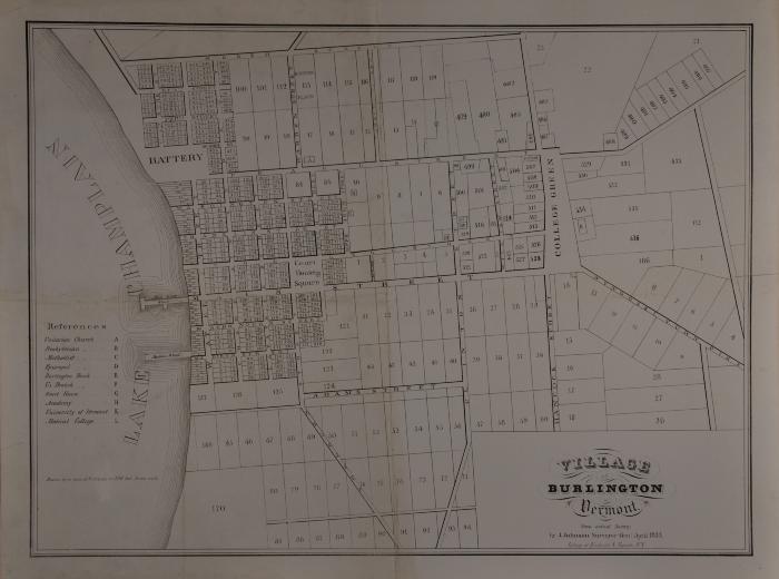
Village of Burlington in Vermont From Actual Survey
Llewellyn Collection of Vermont History
Published Materials
Identifier
2013.1.46Date
1833 (Exact Date)Place of Publication
NYObject Type
MapsDescription
Framed lithographed map of downtown Burlington surveyed by J. Johnson, bounded by Lake Champlain, North Street, East Avenue, and the intersection of what is now St. Paul and South Willard Streets. Landmarks include "Court House Square" [City Hall Park]; Battery Park; the University of Vermont and University Green; the Unitarian, Presbyterian, Methodist, and Episcopal Churches; the courthouse, Burlington Bank, and the "Academy."Dimensions
66 cm (W) 50.2 cm (H)Material
PaperSubjects
City Hall Park (Burlington, Vt.) (depicts)Burlington (Vt.)--Description and Travel (depicts)
First Unitarian Church (Burlington, Vt) (depicts)
St. Paul's Episcopal Church (Burlington, Vt.) (depicts)
First Methodist Church (Burlington, Vt.) (depicts)
University of Vermont (depicts)
Battery Park (Burlington, Vt.) (depicts)
Burlington (Vt.) -- Waterfront (depicts)
Burlington (Vt.)--Maps (depicts)