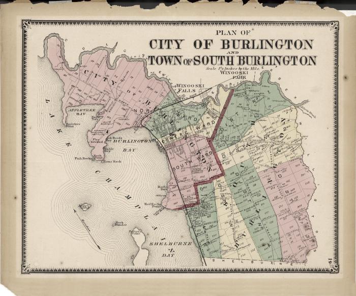
Plan of City of Burlington and Town of South Burlington
Llewellyn Collection of Vermont History
Published Materials
Identifier
2010.1.539Date
1869 (Exact Date)Object Type
MapsDescription
Plan of the City of Burlington, Vermont and Town of South Burlington, Vermont, removed from a copy of F.W. Beers' Atlas of Chittenden Co., Vermont; from actual surveys by and under the direction of F. W. Beers, assisted by Geo. P. Sanford & others (Plate 19).Dimensions
39.7 cm (W) 32.8 cm (H)Material
PaperRelated person
Llewellyn, Lance A.Subjects
Burlington (Vt.)--Maps (depicts)Burlington (Vt.) -- Waterfront (depicts)
Rock Dunder (Vt.) (depicts)
Red Rocks Park (South Burlington, Vt.) (depicts)
Rock Point (Burlington, Vt.) (depicts)
Burlington Bay (Burlington, Vt.) (depicts)
Vermont Episcopal Institute (Burlington, Vt.) (depicts)
Lakeview Cemetery (Burlington, Vt.) (depicts)
Winooski River (Vt.) (depicts)
Odzihozo (depicts)